Hiking trip through saturated landscape in S.W. Scotland

Today, my wife and I joined a small hiking group which followed a cross-country route between Faifley and Milngavie in S.W. Scotland, about eight miles north of Glasgow. This covered a section of a long-distance trail known as the Clyde Walkway, although the River Clyde was not in view.
At this time of year it is reasonable to expect low temperatures and a landscape covered with snow ands ice. However, this was not to be.Instead, there was a continuance of recent weather patterns consisting of relatively mild temperatures, overcast skies and more-or-less constant rain.
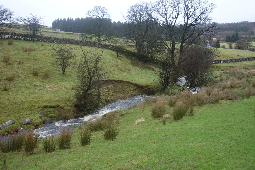
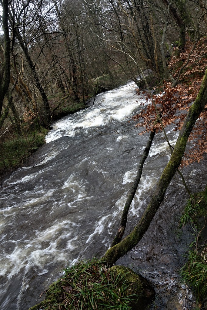
Because of the weather conditions, the land underfoot was saturated and could be compared with walking over a giant, moisture filled sponge. Coupled with this, streams and rivers were in full spate with some waterfalls evident.
The hike covered about seven miles in course of which we encountered a diversity of sites and experiences including:
- Prehistoric 'cup marks' carved into an exposed rock face and probably dating from the Neolithic period or even earlier, around 5000 years ago.
- A mixture of landscapes.
- A huge sand and gravel quarry with an information board describing the local geology
- Some very muddy trails.
- Fungi, which are an essential part of the eco system and thrive in the damp, wet climate.
- Streams and waterfalls.
- Flocks of sheep
- Cattle.
- A high-end golf club.
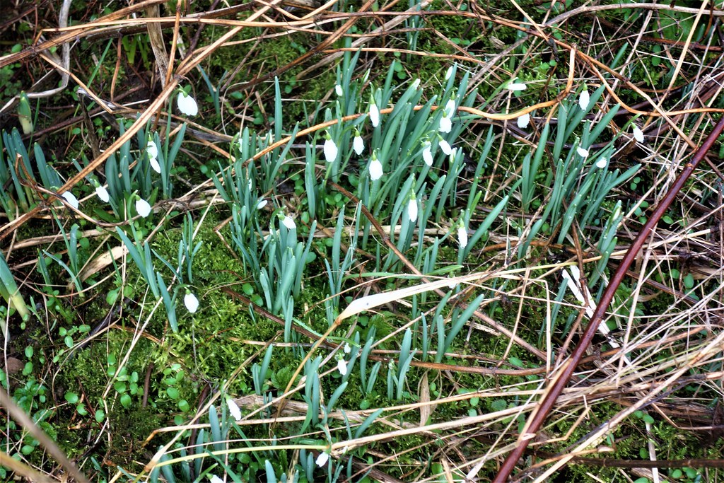
- Early Spring snowdrops in flower.
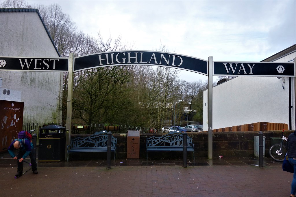
- Official start of the West Highland Way, another long-distance hiking trail which stretches north for nearly 100 miles.
Prehistoric cup marks. Such are widespread in Scotland, being usually found on exposed, smooth (glaciated) rock surfaces with underlying purpose not known.

Tunnel through the landscape

Hiking group with quarry in background

Mud, glorious mud!

Fungi on rotting wood.

'Pop up' waterfalls as a consequence of the heavy precipitation. What appear to stakes in the ground are actually protective covers for young trees, to keep deer and rabbits at bay.

Landscape view
Inquisitive sheep

Snowdrops
Cow with young calf

Public road dissecting farmhouse and buildings

Saturated landscape

Golfers at Milngavie Golf Club

Allander Water (river)
Fungi

Start/finish of hiking trail, West Highland Way, at Milngavie (pronounced 'Mullguy')
Part of shopping area at Milngavie

Overall, a satisfying trip. We returned to Glasgow by rail.


Comments
Post a Comment