Hike Antonine Wall, Scotland
This morning, I joined a small group of hikers on a 6.5 mile route which entailed visiting a section of the 1900 year old Antonine Wall which was built by the Romans and for a short period was the northern frontier of the Roman Empire. The hike commenced and ended about 18 miles N.E. of Glasgow in S.W. Scotland at Kilsyth.
Detailed information on the Wall is provided below. The driver behind construction was political rather than military and it operated as a 'trip wire' as distinct from an impenetrable barrier. At this time, the opponents of the Romans were a race of indigenous people called Picts, about 300 years before arrival of the Gaelic speaking Scots from Ireland.
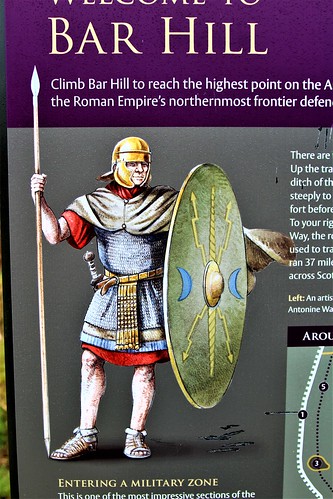
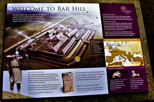
Illustration of Barr Hill fort which sits at highest point on line of the Wall
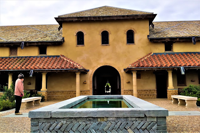
Remains of bath house at Barr Hill fort
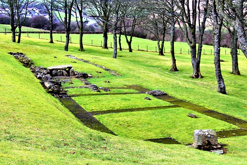
Illustration of fort at Croy Hill
Wide valley in front of the Wall. View N.W. from Barr Hill
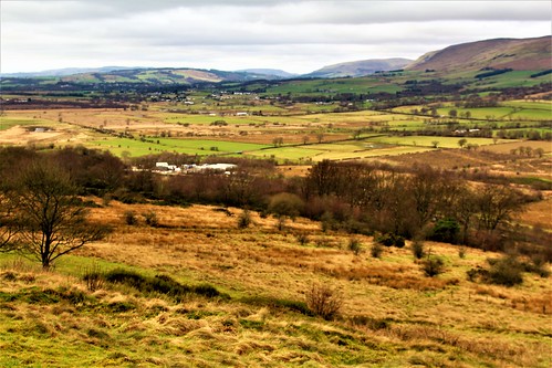
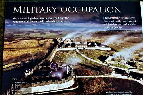
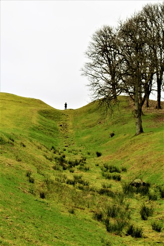
Illustration of defensive ditch in front of the Wall
Landscape view of line of the Wall.

Line of Wall looking east from Barr Hill.Remains of the Wall today mainly comprise a ditch, which sat in front.of the Wall, and probably reached a depth of 9 feet.

Detailed information on the Antonine Wall
The Antonine Wall is a turf structure stretching east-west across Scotland between the rivers Forth and Clyde (Edinburgh and Glasgow) and covering a distance of 37 miles (59 Km). It is named after the Roman Emperor Antoninus Pius who ruled from AD 138-161. Construction of such a wall may have been politically inspired to enhance the status of Antoninus who had succeeded the ‘consolidator’, Hadrian. In July 2008 the Antonine Wall was designated a part of the Roman Empire World Heritage Site.
The 51 year old Titus Aurelius Antoninus (born Titus Aurelius Fulvus Boionius Arrius ) was the second choice of the childless Hadrian to become Emperor. As an administrator with no military experience it is thought that Hadrian viewed Antoninus as a sound choice to continue his (Hadrian’s) non-expansionist policies.
There is no meaningful evidence of a military imperative for the abandonment of Hadrian’s Wall (built about AD122-130) and relocation of the frontier in Britain a modest 100 miles (160 Km) north to the Forth-Clyde region. The initiative may well have driven by the need to provide Antoninus with a military triumph at the commencement of his Emperorship and thereby secure his standing in Rome.
The Roman presence in Britain lasted from AD 43 to AD 410. The Antonine Wall venture was neither the first nor last excursion into what is now Scotland which at the time was occupied by tribes including the Caledonii from where the name Caledonia emanates. Moving the frontier to the new Antonine Wall entailed reoccupation of sites and forts built around the period AD 77-AD 84 (possibly earlier) when the Emperor Vespasian established the Gask Ridge frontier in, mainly, modern day Perthshire.
The Antonine Wall dates from the period AD 139-142, with the latter date coinciding with the abandonment of Hadrian’s Wall to the south. It was built from east to west, ran from Bridgeness on the banks of the river Forth to Old Kilpatrick on the river Clyde and covered a distance of 37 miles (40.5 Roman miles). Constructed on a 14 ft. wide stone base, the turf built rampart was probably 10ft. high and 6ft. at top width.
Construction of the Wall (a term which includes the Military Way, ditch, rampart and other structures) was undertaken by soldiers from the legions II Augusta, VI Victrex pia fidelis and XX Valeria Victrix. It is estimated that the construction force may have totalled some 8000 men comprising a mix of legionaries and auxiliaries who between them possessed the full range of specialist skills necessary for such a project. From this era we have a legacy of some 20 Distance Slabs which are elaborately embellished carved inscriptions on stone tablets which record individual stretches of construction by detachments of the three legions. Studies of the Slabs suggest that the construction project was divided into 15 sectors.
Along the line of the Wall there may have been 26 forts (of which 17 are known) with the six principal ones at Barr Hill, Carriden, Mumrills, Castlecary, Balmuildy and Old Kilpatrick. Other sites are: Bishopton, Duntocher, Cleddans, Castlehill, Bearsden, Summerston, Wilderness Plantation, Cadder, Glasgow Bridge, Kirkintilloch, Auchendavy, Croy Hill, Westerwood, Seabegs, Rough Castle, Watling Lodge, Camelon, Falkirk, Inveravon and Kinneil. The garrison complement of the six primary forts may have been 4000 soldiers.
There appears to be no agreement on the precise date for abandonment of the Antonine Wall although there is a consensus that AD 158 witnessed the start of what may have been a progressive withdrawal. This time coincides with rebuilding work on Hadrian’s Wall which was reoccupied from about AD 160.
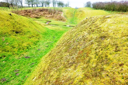
For illustration purposes, here is a well-preserved section of the Wall from Bonnybridge near Falkirk.


Comments
Post a Comment