Romans in Southern Scotland
Today, we visited two Roman sites: Burnswark Hill (which lies a couple miles
east of Lockerbie in the Scottish Borders region) and Birrens Roman Fort (Blatobulgium) which is about two miles south of Burnswark.
Lockerbie will be remembered as the site of the terrorist
disaster in 1988 when 270 persons died consequent upon an explosion on Pam Am
103.
In viewing the images readers should remember the Roman sites are around 1800 years old and have been subject to depredation of the Scottish climate. The defensive ditches will have been subject to infill due to erosion whilst the defensive earthen banks would, during the Roman era, have been complemented with palisades, maybe six feet high. Remains today represent the basic foundations.
Burnswark Hill
Burnswark Hill has a height of 942 feet and displays a
complex archaeological record.
It appears that human occupation of Burnswark dates back to
the prehistoric period, possibly to 3000BC. During the Iron Age, which dates
from around 800 BC to 43 AD, there appears to have been a ‘fort’ or defended
settlement on the hill, such being a common feature all over the British Isles
during that period with each assumed to be the power base of a local chieftain
or community leader in context of tribal society.
The Romans arrived in AD 43 and progressively worked north
from what is now southern England reaching as far north as Aberdeen in what is
now Scotland. The adversaries of the Romans were local tribes known
collectively as Picts (or painted people) who. despite having relatively
primitive military technology and tactics, managed to prove worthy opponents of
the Romans over a long period.
The Romans undertook various military campaigns in Scotland
over the first, second and third centuries AD but failed to conquer and
ultimately withdrew to the line of Hadrian’s Wall which ran coast to coast in
what is now northern England.
The defining military legacy of the Romans in Scotland is
the Antonine Wall, which ran coast to coast spanning a distance of 37 miles and
formed the northern frontier of the Roman Empire from AD142 to AD 165.
In addition to the Antonine Wall, the Romans built some
forts north of Hadrian’s Wall. Archaeologists have also discovered (with
benefit of aerial photography) about 155 temporary camps most of which are in
in modern-day Scotland. These camps take the form of rectangles or squares
surrounded by a defensive ditch. They were constructed as temporary ‘marching
camps’ during military campaigns. Distribution is restricted to the Scottish
Borders region, central Scotland and eastern Scotland.
The Roman camps on Burnswark Hill have given rise to much
debate. The site is unusual in that there is a camp on each of the north (6.5
acres) and south (12 acres) banks with evidence suggesting they could have been
used in siege tactics to take the Pictish site on the hill top. However, sieges
did not usually feature in Roman campaigns and there is archaeological evidence
in form of multiple spearheads, lead sling-bullets arrow heads and ballista
balls to suggest that the two Roman camps may have been used for training
purposes.
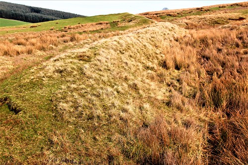
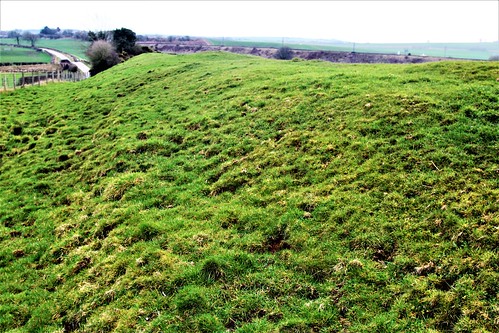
Defensive wall at Burnswark South

Defences at Burnswark South
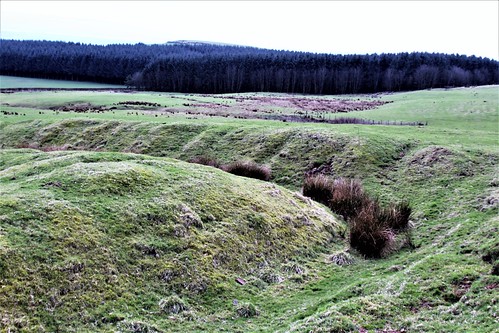
Defences at Burnswark South

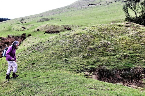
Three mounds at Burnswark South which are believed to have been the platforms for ballista positions. The ballista was a weapon akin to a giant crossbow which was used to launch projectiles at distant targets.
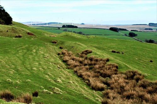
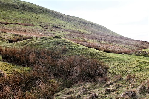
Defences of Burnswark South
Defences of Burnswark South
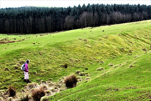
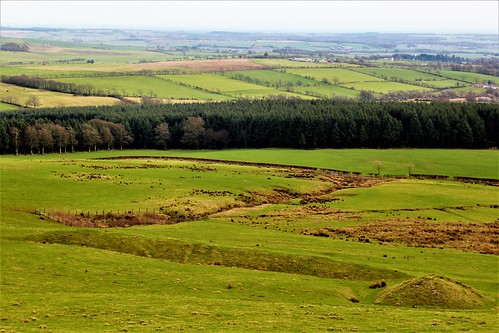
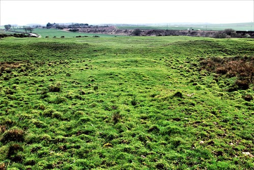
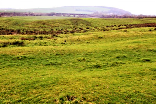
Landscape view south from Burnswark Hill including part of the Roman Camp defences.
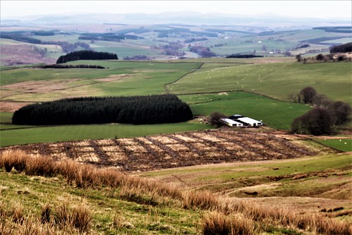
Looking north from Burnswark North with camp earthworks in bottom right corner of image.
Perimeter defences at Burnswark North
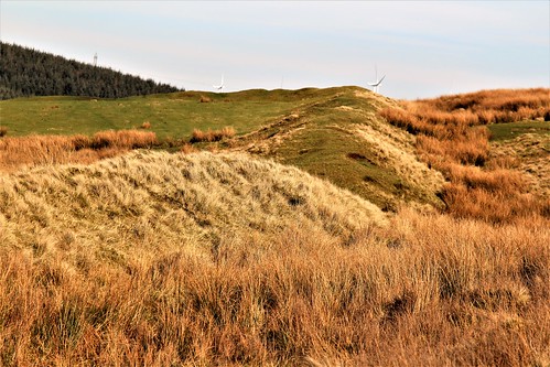
Perimeter defences at Burnswark North
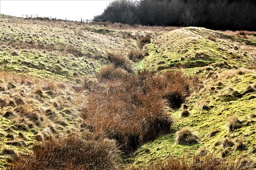
Perimeter defences at Burnswark North
Entrance gate defence at Burnswark North
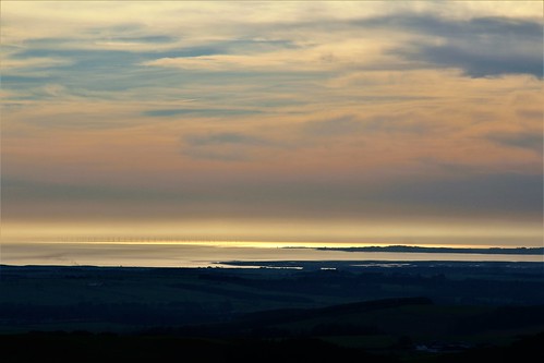
Sunset over the Solway Firth from summit of Burnswark Hill
Birrens Roman Fort (Blatobulgium).
Blatobulgium is recorded in the Antonine Itinerary which is a register of the stations and distances along various Roman roads.. The name derives from Brittonic (Welsh) roots and may mean 'flowery hillock' or 'flowery hollow'. However, as there are granaries at the fort, Blatobulgium may be a nickname meaning 'Flour Sacks'.
The fortress formed the northern terminus of the Roman-era Watling Street, Route 2 of the Antonine Itinerary. It was located in the territory of a tribe named the the Selgovae.
There have been more inscribed and sculptured stones found at Birrens than anywhere else in Scotland. An altar stone dedicated to the Celtic goddess Ricagambeda was found at Birrens.
Interestingly, there is a concentration of Roman military sites at Birrens. In addition to the fort (illustrated) there is evidence of, potentially, three temporary camps.
Fort interior
Principal perimeter wall
Outer defences
Comments
Post a Comment