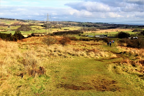
Antonine Wall, Scotland

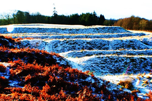
(Above image is a capture of the Wall near Bar Hill.)
The Antonine Wall is a turf structure stretching east-west between the rivers Forth and Clyde (Edinburgh and Glasgow) and covering a distance of 37 miles (59 Km). It is named after the Roman Emperor Antoninus Pius who ruled from AD 138-161. Construction of such a wall may have been politically inspired to enhance the status of Antoninus who had succeeded the ‘consolidator’, Hadrian.
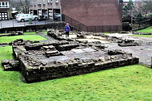
Foundations of Wall at New Kilpatrick Cemetery, near Bearsden.

In July 2008 the Antonine Wall was designated a part of the Roman Empire World Heritage Site.
The 51 year old Titus Aurelius Antoninus (born Titus Aurelius Fulvus Boionius Arrius ) was the second choice of the childless Hadrian to become Emperor. As an administrator with no military experience it is thought that Hadrian viewed Antoninus as a sound choice to continue his (Hadrian’s) non-expansionist policies.
There is no meaningful evidence of a military imperative for the abandonment of Hadrian’s Wall (built about AD122-130) and relocation of the frontier in Britain a modest 100 miles (160 Km) north to the Forth-Clyde region. The initiative may well have driven by the need to provide Antoninus with a military triumph at the commencement of his Emperorship and thereby secure his standing in Rome.
The Roman presence in Britain lasted from AD 43 to AD 410. The Antonine Wall venture was neither the first nor last excursion into what is now Scotland which at the time was occupied by tribes including the Caledonii from where the name Caledonia emanates. Moving the frontier to the new Antonine Wall entailed reoccupation of sites and forts built around the period AD 77-AD 84 (possibly earlier) when the Emperor Vespasian established the Gask Ridge frontier in, mainly, modern day Perthshire.
The Antonine Wall dates from the period AD 139-142, with the latter date coinciding with the abandonment of Hadrian’s Wall to the south. It was built from east to west, ran from Bridgeness on the banks of the river Forth to Old Kilpatrick on the river Clyde and covered a distance of 37 miles (40.5 Roman miles). Constructed on a 14 ft. wide stone base, the turf built rampart was probably 10ft. high and 6ft. at top width.
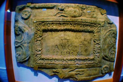
Construction of the Wall (a term which includes the Military Way, ditch, rampart and other structures) was undertaken by soldiers from the legions II Augusta, VI Victrex pia fidelis and XX Valeria Victrix. It is estimated that the construction force may have totalled some 8000 men comprising a mix of legionaries and auxiliaries who between them possessed the full range of specialist skills necessary for such a project. From this era we have a legacy of some 20 Distance Slabs which are elaborately embellished carved inscriptions on stone tablets which record individual stretches of construction by detachments of the three legions. Studies of the Slabs suggest that the construction project was divided into 15 sectors.
Distance slab at Cumbernauld Shopping Centre
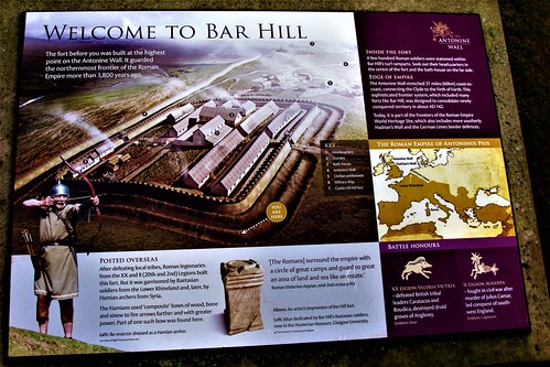
Along the line of the Wall there may have been 26 forts (of which 17 are known) with the six principal ones at Bar Hill, Carriden, Mumrills, Castlecary, Balmuildy and Old Kilpatrick. Other sites are: Bishopton, Duntocher, Cleddans, Castlehill, Bearsden, Summerston, Wilderness Plantation, Cadder, Glasgow Bridge, Kirkintilloch, Auchendavy, Croy Hill, Westerwood, Seabegs, Rough Castle, Watling Lodge, Camelon, Falkirk, Inveravon and Kinneil. The garrison complement of the six primary forts may have been 4000 soldiers.
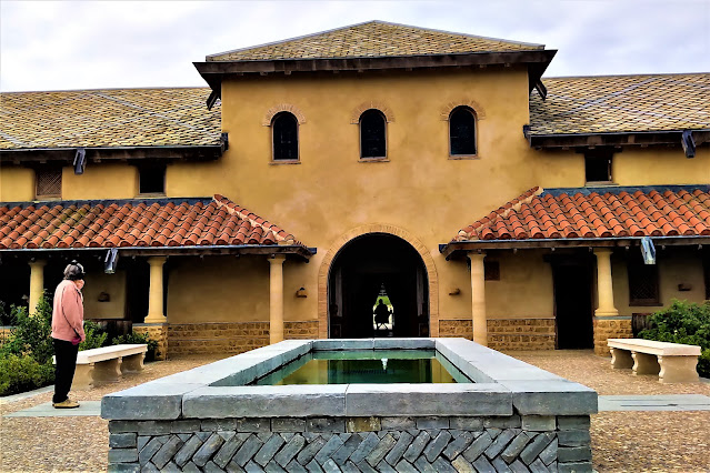
Regimental Bath House at Bearsden Roman Fort
Roman Bath House at Bar Hill Fort
Artist's impression of Bar Hill Roman Fort.
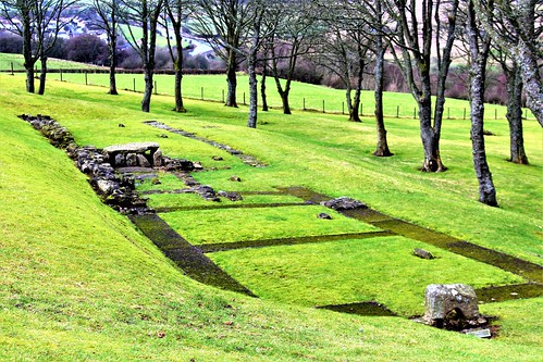
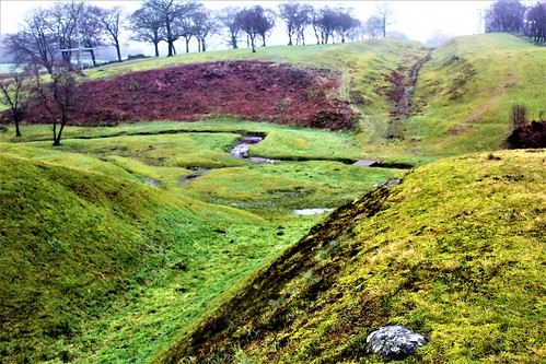
Site of Croy Hill Roman Fort
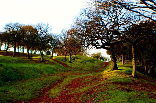
Section of Wall at Seabegs Wood near Bonnybridge
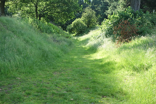
Section of Wall at Rough Castle, Bonnybridge
Section of Wall at Falkirk
Fortlet at Kinneil

From the time of the Wall construction, forts dating back to the Gask Ridge era, such as Ardoch, Strageath and Bertha, were brought back into use.
Ardoch Roman fort in winter.
There appears to be no agreement on the precise date for abandonment of the Antonine Wall although there is a consensus that AD 158 witnessed the start of what may have been a progressive withdrawal. This time coincides with rebuilding work on Hadrian’s Wall which was reoccupied from about AD 160.
During the last 13 years of his reign Antoninus effectively shared power with Marcus Aurelius, his adopted son, son-in-law and chosen successor. Antoninus died on March 7th 161 AD age 74 years at Lorium after an Emperorship lasting 22 years and nine months during which period the Empire is generally acknowledged to have experienced a period of peace and prosperity-perhaps vindicating Hadrian’s succession planning!
Further information can be obtained by visiting the Hunterian Museum, Glasgow which has a gallery dedicated to the Wall.

Visiting the Antonine Wall
There is no continuous path linking the length of the Antonine Wall. For persons wishing to connect with the Wall the following sites are accessible by motor car:
Bearsden: 8 Roman Ct, Bearsden, Glasgow G61 2HS
Rough Castle: Bonnyside Road,Bonnybridge,Stirlingshire,FK4 2AA
Falkirk:Callendar House, Callendar Rd, Falkirk FK1 1YR
Kinneil: Kinneil Estate, Bo'ness EH51 0PR


The representation of this article is actually superb. I think this is a genuinely beneficial and instructive article for everyone, I appreciate this kind of writing, Thankful to you for sharing an article like this.Retaining Walls Oregon
ReplyDelete