Hike West Highland Way
This evening, I am posting summary information on the 95 mile long West Highland Way hiking trail which runs from Milngavie (Glasgow) in S.W Scotland to Fort William, directly north, in the Highlands.
Hints and Tips
- Most participants travel from south to north although there is no obligation to do so.
- In the summer life can be made unpleasant by midges, tiny mosquitoes, which are notorious for their bites.Various counter measures are available including skin creams and headnets.
- The route is usually best attempted between Spring and Autumn (Fall). Some outdoor activity companies will provide a package comprising itinerary, lodgings and baggage transfer.
- Variations of this route are available. There is no obligation to cover the entire 95 miles.
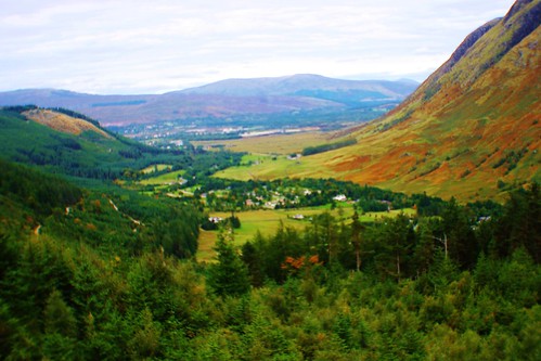
DAY 1
Landscape
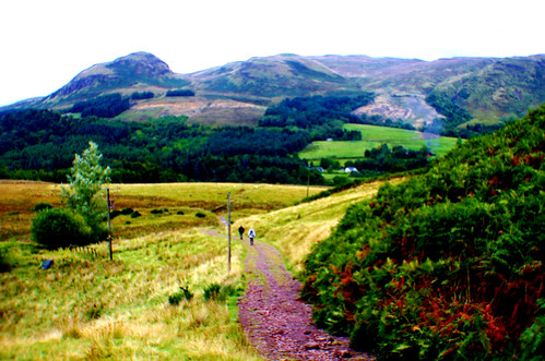
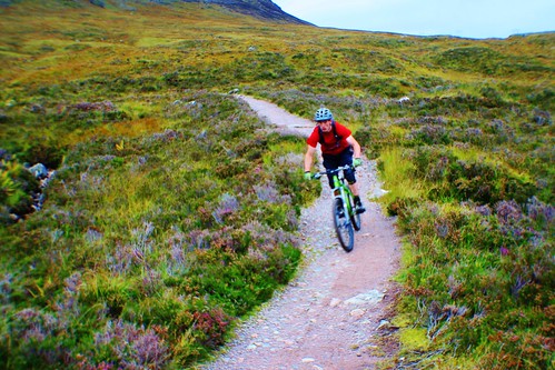
About half of this first leg follows the line of a defunct railway line and is easy terrain to navigate. The rest of the trail uses trails and paths which are also relatively easy-going.
Distance is about twelve miles.
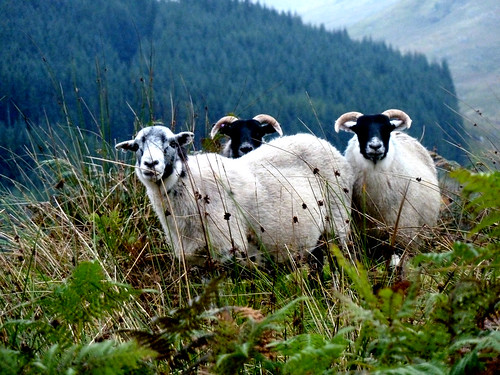
Special features: cattle, wildflowers, Glengoyne Distillery.
Landscape view with Glengoyne Distillery
DAY 2
This is a
14 mile section from Drymen to Rowardennan, most of which follows the
eastern bank of Loch Lomond.
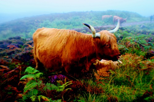
Highland Cow
The first section covers Drymen to Balmaha, starting with gentle Trossachs landscape the route entails a gentle incline passing through farmland to a commercial forestry and logging area then into Garadhban forest which comprises non-native conifers, principally spruce and larch. This went on to merge with the Queen Elizabeth Forest Park.
The next section includes a sharp ascent up Conic Hill (1175 ft).
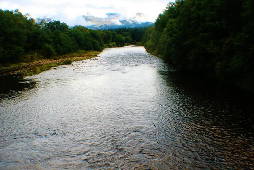
View of Loch Lomond
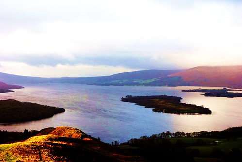
Balmaha
Final stage is the section to Rowardennan along a less demanding trail which mainly follows the eastern bank of Loch Lomond. Along the way, scenery changes from conifers to deciduous (oak, alder, etc.).
DAY 3
This section is 14 miles in length and starts relatively easy but the trail becomes progressively more demanding with rough surface of hard rock.
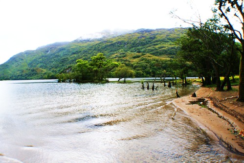
The hike commences at Rowardennan with easy-going along the bank of Loch Lomond. Here, trees include oak, ash and alder with broom bushes in evidence.
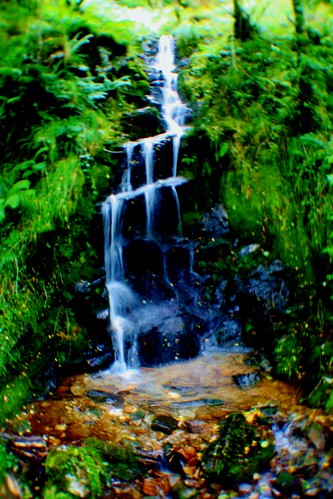
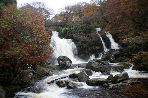
A feature of this section is the high incidence of waterfalls and streams draining off Ben Lomond, a mountain just to the east.
The trail passes through Craigrostan Wood, an ancient woodland containing native oak trees.
On reaching Inversnaid refreshments are available at the hotel which is close to an impressive waterfall known as the Falls of Inversnaid.
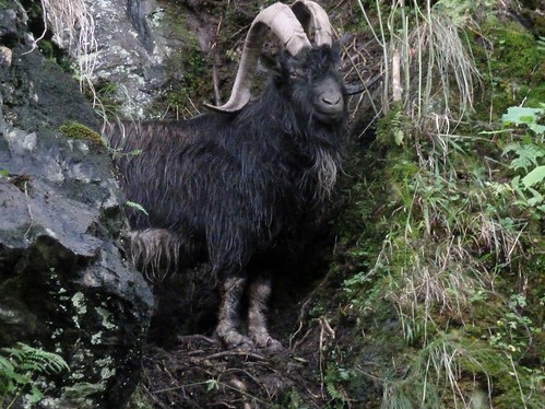
Moving on towards destination of Inverarnan the (rocky) conditions underfoot become more challenging. On this path hikers may encounter a small group of feral goats.
Final destination for the night is Inverarnan.
DAY 4
This segment covers about 12 miles travelling North-East.
The trail of the first section follows Glen Falloch and the River Falloch from Beinglas Farm, Inverarnan to Crianlarich. Key features:
Starts with easy-going section along a well maintained track, more or less following the River Falloch. Beech, oak and alder trees are in evidence. Numerous streams cross the trail at right angles. The landscape features numerous small waterfalls.
Section Two entails a sharp turn near Crianlarich and then follow the River Fallon (Strath Fillan) up to Tyndrum. Key features of this section:
- A rougher trail with short, sharp gradients through conifer forests and open landscape.
- Subject to timing, it may be possible to spot the Jacobite Express ( 'Harry Potter Train') steaming through the landscape in the distance.
- Lots of rocky outcrops with heather.
- A variety of fungi.
- Remains of St Fillan’s Priory which date from the 13th century.
- In the distance can be seen the Crianlarich Hills which comprise Ben More, Stob Binnein and Cruach Ardrain.
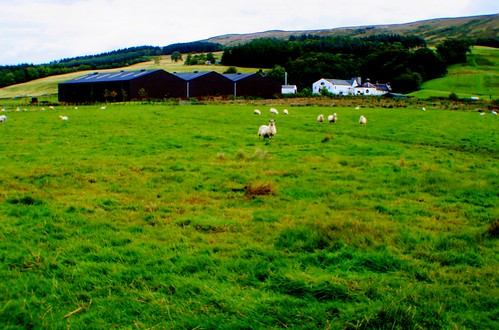
- A potential lunch stop is Strathfillan Wigwams site. This locale is predominantly farmland and used for sheep grazing.
- In the distance are the Tyndrum Hills which comprise Beinn Dubhcraig, Ben Lui and Beinn Chuirn. The defunct Cononish Gold Mine is also evident.
- Close to the River Cononish is a sign marking the site of the Battle of Dalrigh in 1306.
- At Tyndrum is a piece of waste land created by lead mining and ore processing in days past. The pollution prevents growth of vegetation and trees.

DAY 5
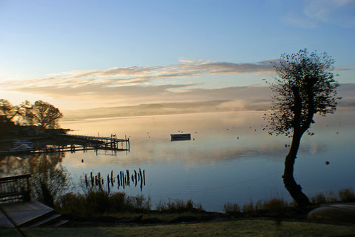
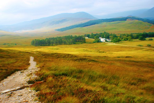
This route covers a relatively modest 10 miles, from Tyndrum to Inveroran:
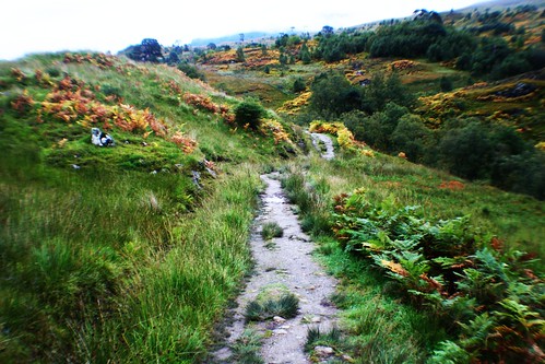
Landscape view
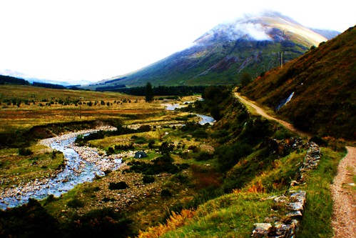
- Depart Tyndrum, Perthshire heading North initially past some interesting wood carvings and then connect with the Old Military Road (18th c) which in turn follows the course of a stream. The trail moves into open landscape with a flat valley (strath). Here is grassland, possibly with sheep and cattle grazing.
- Past two mountains named Beinn Odhar and Beinn Dorain.
- The first seven miles to Bridge of Orchy is relatively easy-going along a well maintained path/trail which more or less follows the line of the River Orchy to the east.
- Bridge of Orchy should be reached about midday where refreshments are available at the hotel.
- After Bridge of Orchy the trail diverts to a N.W. direction and becomes tougher going , ascending to 1000 ft.
- Initially, the trail passes through conifers with some fungi evident, then on to open moorland with heather. This high elevation offered good views including Loch Tulla.
This is the longest single section, extending to 18 miles.
- The first leg covers 10 miles, from Inveroran to Kingshouse Hotel. Here the trail is well maintained thus facilitating a good pace on a gently rising elevation, to 1000 ft.
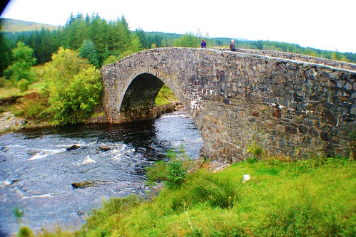
- After Loch Tulla cross Victoria Bridge and join the Old Parliamentary Road which was built in the early 19th century but is no longer open to traffic.Mountains are usually visible in the distance. Pass a conifer forest and native trees including beech, birch, rowan and holly.
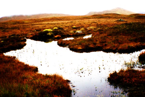
- Most of this sub-section entails a hike across Rannoch Moor which in essence is a desolate place comprising a giant peat bog featuring rocky outcrops, small lakes and heather in places.
- Aim to reach Kingshouse Hotel, Glencoe for midday.Refreshments are available.
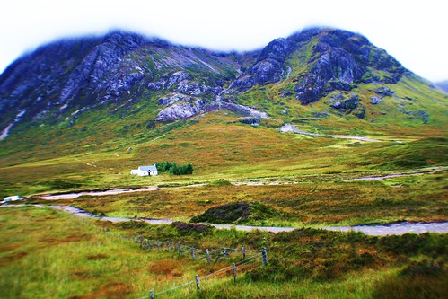
- After departing Kingshouse there is a flat stretch and then a sharp, steep climb up to 1850 feet along the 'Devil’s Staircase'. This was originally built by the British military in the 18th century.
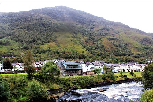
- After reaching the top of the Devil’s Staircase the trail became less challenging and leads to Kinlochleven passing a massive hydro-electric scheme en-route. This scheme dates from the early 20th century and was constructed to process aluminium.
- Overnight at Kinlochleven.
This is the final leg entailing a 15 mile stretch ending in the centre of Fort William. A brief summary as follows:
- Depart Kinlochleven after breakfast.
- A steep uphill climb on a rough track for about 30 mins. Here, he trail crosses numerous small waterfalls and streams. Vegetation is thick, mainly comprising birch, beech and rowan. Ferns are also in evidence.
- After the climb, the path suddenly bursts into open moorland and mountains with Loch Leven on the left.
- The trail navigates across Lairigmor which is one of the finest ridge walks in Scotland, offering views of 11 Munros (mountains over 3000 ft.).
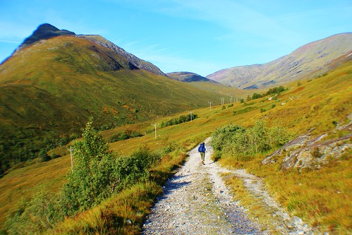
- Later, the trail dips into a valley and lower elevations and then on through a conifer plantation and a logging landscape. Subject to visibility, good views of Ben Nevis can be obtained.
- The last section entails a progressive downhill route on a good quality unsurfaced road. Eventually, the Ben Nevis Visitor Centre is reached where refreshments are available before embarking on the final lap to Fort William and conclusion of the hike.

More information on Scotland.
The publication Visitors’ Guide to Scotland comprises a vast array of information on 800 pages, including the West Highland Way.. ISBN is 978-1-9161`332-0-4. Also available via Kindle.


Comments
Post a Comment