West Highland Way (Scotland)- Day 2
Today, I covered the section between Drymen and Balmaha which takes me to the shores of Loch Lomond from where I am writing this.
Distance covered was around seven miles entailing an ascent of about 1200 feet.
The highest point was Conic Hill (1175 ft.) just to the east of Balmaha although I did not attempt the final section to the summit owing to the difficult, flakey, conditions entailing climbing on 'all fours'.
Highland cows on landscape. These animals are, technically, in their natural habitat of the Highlands region, being just north of the fault line.

Weather
Today, conditions were as forecast: basically dry but with heavy cloud. Temperature was ambient and wind light. Good conditions for hiking but less so for photography.
Topography
A gentle gradient which progressively increased as I approached Conic Hill. The first half of the trail passed through Garadhban Forest which is actually commercial woodlands.However, along this route was a wide variety of flora, shrubs and trees. The landscape was very wet. Progressively improving views of Loch Lomond were provided as the ascent progressed.
Trail through forest

Trail at lower elevations

Landscape at lower elevations

Very wet ground surface at lower elevations.
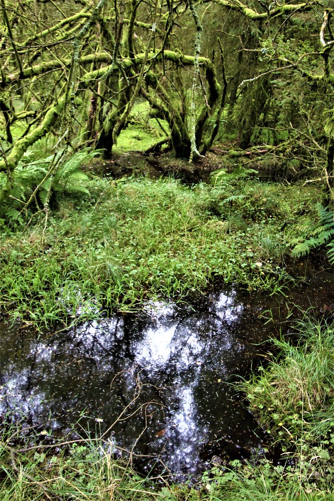
Pond at high elevation with Loch Lomond just visible in distance

Climb to/from Conic Hill

Flora, shrubs and trees
Heather, ferns and evergreens

Wild flower

Wild flower

Seed pods on Scotch Broom

Geology
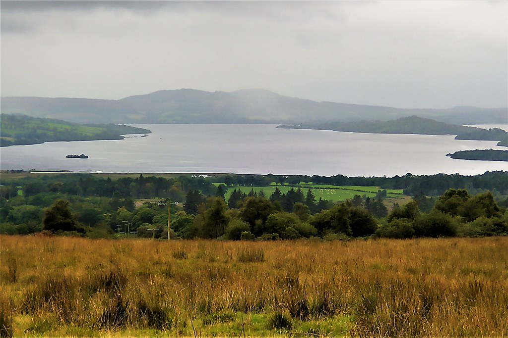
The key feature today is encounter with the Highland Bounday Fault.This was formed about 430m years ago when rocks from Lowland Scotland collided with rocks from the north resulting in a 'crumple zone'. This fault line stretches from Stonehaven on the east coast to Kintyre in the west and passes through Conic Hill. The rocks in and around Conic Hill fall into the conglomerate category.
Conic Hill (near Balmaha)
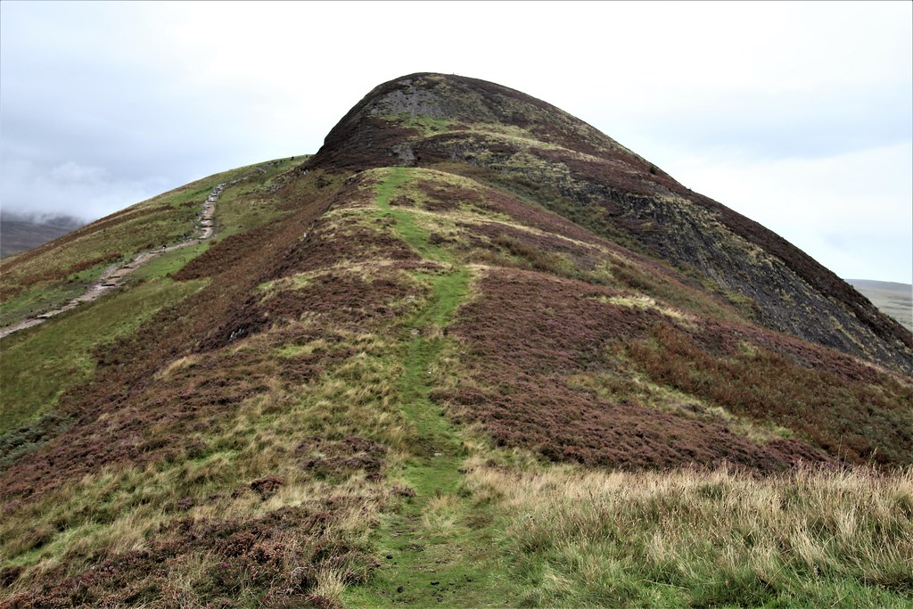
Image below shows the Highland Boundary Fault (as manifested in the chain of islands in Loch Lomond) from slopes of Conic Hill.

Loch Lomond
This is a glacial lake extending to 28 sq miles, 24 miles in length and up to 5 miles in width.This loch has the largest surface area of any body of fresh water in the U.K. The loch is only 23 feet above sea level but the glacially excavated floor reaches a depth of 623 feet.
View of Loch Lomond from a low elevation
Marina on Loch Lomond at Balmaha

Tomorrow, I continue along the east bank of Loch Lomond to Rowardennan. Wet weather is forecast.


Comments
Post a Comment