Rannoch Moor, Scottish Highlands
 Rannoch Moor with surrounding mountains in winter
This evening, I am posting information on Rannoch Moor in the Scottish Highlands.
A moor is a word used in Britain to describe a relatively high elevation of landform which is usually inherently wet and/or otherwise unsuitable for agriculture or settlement.
Vast numbers of visitors do, in fact, traverse Rannoch Moor using the A82 en-route to/from popular spots such a Glencoe and Fort William without appreciating the story behind the rugged and usually bleak landscape.


View across the moor in winter
The Rannoch Moor plateau is at an altitude of about 1200 feet and surrounded by a rim of mountains. The core rock is granite which has been eroded by severe glacial erosion. In fact, this is where the last ice sheet to cover Scotland originated about 25,000 years ago and where the ice finally melted about 10,000 years ago. The landscape has been fashioned by glacial ice movements resulting in numerous irregularly shaped lakes separated by hummocks of glacial debris. The glacial ice radiated out from Rannoch Moor north-east to the Spey, eastwards to the Tay, southwards to the Clyde and westwards to Loch Linnhe.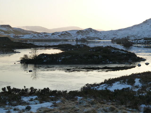 Landscape in winter
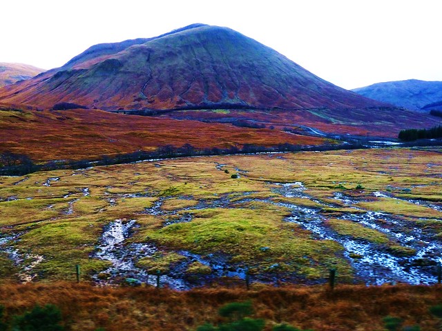
This largely treeless area also forms part of the West Highland Way, a long-distance hiking trail between Glasgow and Fort William.
In the right weather and visibility conditions the Moor provides good opportunities for photography.


Comments
Post a Comment